EDUCATION
Whether it’s use or investment, Drone Education Services provides education for your Real Estate needs.
Our Courses
Click to Learn More
- Types, Uses, & Trends/Rules & Regulations
- Case Study/Field Operations
- Maps, Measurements & Modeling
- Mapping Applications
Types, Uses, & Trends / Rules & Regulations
Do you know the rules? We do. We’ll show you what to look for and how to find the answers to plan and execute a safe and repeatable mission. What is a drone, what are the different types of drones being flown and why? We will discover how real estate businesses are using drones to gather data. These will include appraisers, brokers, insurance agents, attorneys, developers, architects, homeowners, tax assessors and others.


Whether you plan on using a drone for yourself or hiring someone to do it for you, there are necessary steps to be able to incorporate aerial inspections into your practice. Navigate the Federal Aviation Administration’s website and learn the necessary steps required to register your drone and become a certified remote pilot.
Case Study/Field Operations
Do you want to learn how low altitude mapping and modeling are produced with low-cost consumer drones?Develop a planned mission for the aerial inspection of real estate. We’ll discuss the apps that are available to plan your mission and discuss the operational, environmental and regulatory issues involved in keeping people and property safe.


We will cover everything from getting an assignment to delivering the final product. We will discuss the unanticipated hazards that can occur when setting up and performing aerial inspections. It’s more than just buying a drone and charging a battery.
Maps, Measurements & Modeling
Do you want to learn how low altitude mapping and modeling are produced with low-cost consumer drones?
This class is for students who want to learn how low altitude mapping and models are produced with low-cost consumer drones. The stitching together of photographs is called photogrammetry. These stitched photographs can be used to make maps, measure and create 3-dimensional models. Together we will unlock some of the potential of aerial inspections.


Mapping Applications using Skyline Software
What can a map or model do for you? This seminar will cover the necessary steps to creating a model and then learning what you can do with it. Skyline Software Solutions will give each student the opportunity to download a trial version of their software to use and discover the various types of data that can be obtained from an aerial inspection.


You will learn & discover Mapping with:

Course Promos
Did you know that a drone is an uncrewed vehicle? That means Control is either remote control or preprogrammed flight. DRONES are already impacting real estate in unique ways, from underwater bridge inspections, remote trucking, aerial delivery to satellite GIS mapping. Currently there are 3 kinds of aerial drones being used in real estate, the fixed wing which looks like a traditional plane and can glide, a multi-rotor can hover and the VTOL (Vertical take-off and landing) drone which has the abilities and advantages of both. So, are you in an urban or suburban environment? What type of drone is good for you?
Join me and learn about the Types of Drones.
Real estate is a top industry taking advantage of aerial inspections. Drones provide multiple opportunities to service businesses interested in acquiring data. And Aerial inspections enhances your ability to provide more. For appraisers, drones are just another tool in the toolbox for property assessment.
They are used to
• Assist in decision making
• Showcase unique perspectives.
• Provide access to hard to reach places.
• Identify areas of interest.
• Have certifiable real-time data.
To learn about the many real estate opportunities and learn about the many uses of drones in real estate.
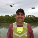
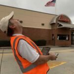
When it comes to safety I make it my main focus when flying. I Make sure that I get the data that my client needs. I just had to find the drone that could get it. For me, my drone has to be reliable, durable, easy to use, have enough air time to complete the mission. And be able to handle multiple missions.
Being successful means ALL OF MY MISSIONS are safe and repeatable.
I have developed the proper procedures for a variety of types of operations.
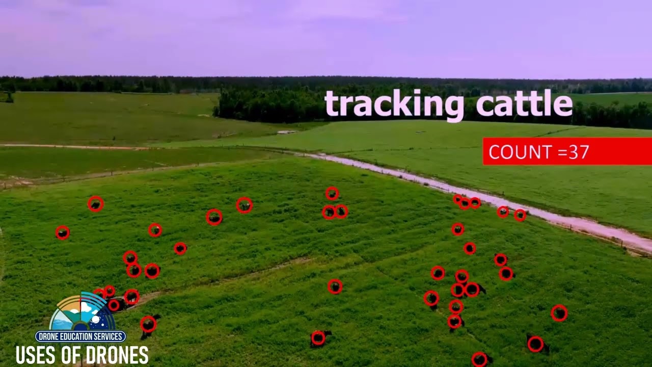
So lets get the necessary information required and learn how to deal with a variety of situations. Those situations could be operational, environmental, or regulatory. If we have a place to fly and clear airspace then we may try a little mapping too.
So, lets
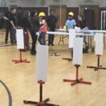
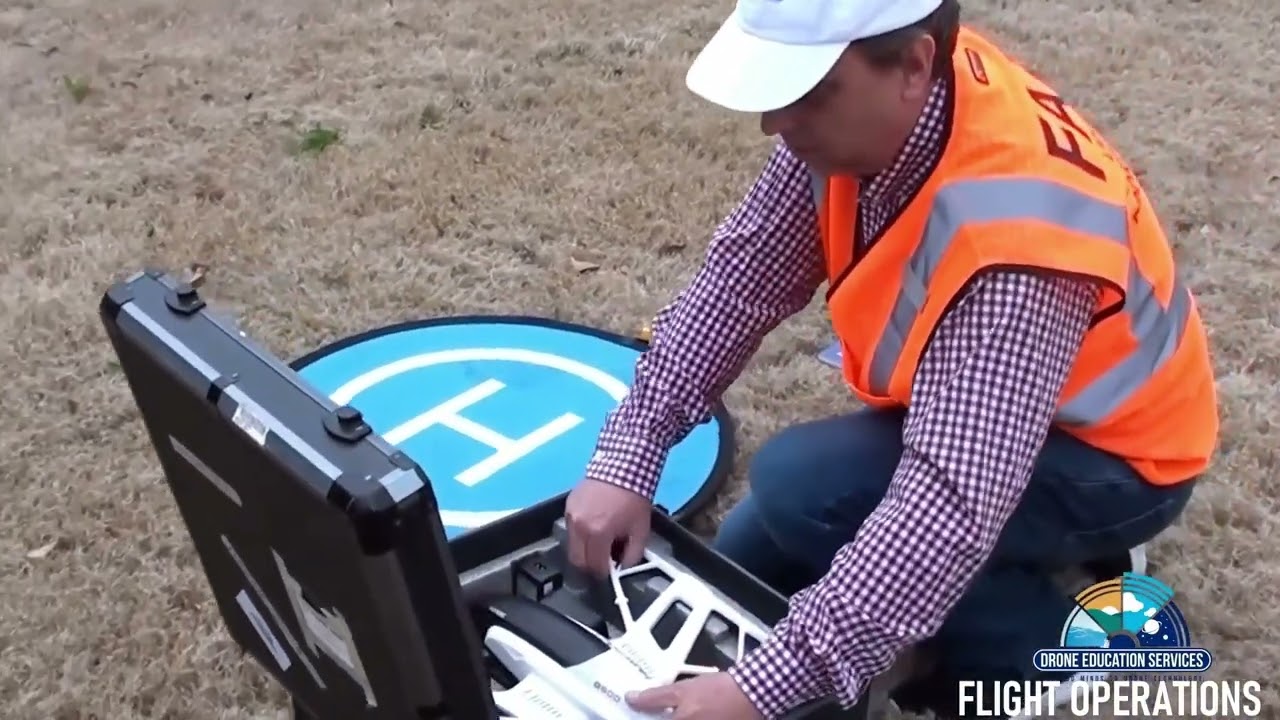
• Set up a safe Launching zone
• Develop a flight plan
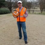
• Determine is we need a crew
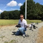
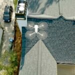
• Take off and Inspect a property
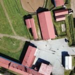
• Run through some shots to make your presentations exciting
• Land safely
• Give ourselves a debriefing on what we learned.
Join me for Flight Operations.
I began working on Maps, Measurements, and Modeling in 2019. The goal is to be able to share with real estate professionals the benefits of aerial photogrammetry. To gain an understanding of the technology I tested the software’s of Drone Deploy, Pix4D, Maps Made Easy, Zephyr and some programs in the BETA testing phase. I finally decided to use Skyline Software Systems, because it is the most versatile. My maps and models were developed during the testing periods with these different softwares and what I created should not dissuade you from trying them out. In fact I encourage using various mapping programs to develop the skills, understand the technology and begin creating useful products for your clients.
BRONZE PACKAGES
Our Educational Programs are designed to be information rich with insights and skills you will be able to put directly to use. We offer our education packages both In-Person and via online Webinar formats. Mix and Match, learn at your pace.
Types, Uses, & Trends/Rules & Regulations
4 HOURS-
One Instructor
-
Real Estate State Credit Available (Ask prior to booking)
-
Free Documentation
Case Study/Field Operations
4 HOURS-
One Instructor
-
Real Estate State Credit Available (Ask prior to booking)
-
Free Documentation
-
Potential Field Training
Maps, Measurements & Modeling
4 HOURS-
One Instructor
-
Real Estate State Credit Available (Ask prior to booking)
-
Free Documentation
Mapping Applications
4 HOURS-
One Instructor
-
Real Estate State Credit Available (Ask prior to booking)
-
Free Documentation
SILVER PACKAGES
Go even farther with our Silver packages. These are Full-Day courses each grouping 2 of our courses together.
Aerial Inspections for Real Estate
Mapping & Modeling Applications
Types, Uses, & Trends/Rules & Regulations
3 HOURS-
One Instructor
-
Real Estate State Credit Available (Ask prior to booking)
-
Free Documentation
Case Study/Field Operations
4 HOURS-
One Instructor
-
Real Estate State Credit Available (Ask prior to booking)
-
Free Documentation
-
Preferred Outdoors
PACKAGE 1
What is a drone, what are the different types of drones being flown and why? We will discover how real estate businesses are using drones to gather data.
Navigate the Federal Aviation Administration’s website and learn the necessary steps required to register your drone and become a certified remote pilot.
We will cover everything from getting an assignment to delivering the final product.
Maps, Measurements & Modeling
4 HOURS-
One Instructor
-
Real Estate State Credit Available (Ask prior to booking)
-
Free Documentation
Mapping Software & Uses
3 HOURS-
Mapping Software (hands-on)
-
One Instructor
-
Real Estate State Credit Available (Ask prior to booking)
-
Free Documentation
PACKAGE 2
This class is for students who want to learn low altitude mapping and models are produced with low-cost drones. We will unlock some of the potential of aerial inspections.
What can a map or model do for you? Create a map and model and then discover the amazing things that Skyline Software Solutions can do for you.
GOLD PACKAGES
This Package combines both of the Silver packages into a comprehensive 2-Day educational event with a combined discounted rate.
Aerial Inspections for Real Estate + Mapping & Modeling Applications
The ULTIMATE package.
Go ALL-IN with 2 full days of education covering all 4 of our courses available for In-Person attendance. Jump on in and get the materials needed to understand aerial inspections and how it is used for real estate. Unlock the potential for newer clients and discover how singular missions can be used over multiple mediums. Gain the insights, tips, and use the best software on the market.
Types, Uses, & Trends/Rules & Regulations
3 HOURS-
One Instructor
-
Real Estate State Credit Available (Ask prior to booking)
-
Free Documentation
Case Study/Field Operations
4 HOURS-
One Instructor
-
Real Estate State Credit Available (Ask prior to booking)
-
Free Documentation
-
Preferred Outdoors
DAY ONE
What is a drone, what are the different types of drones being flown and why? We will discover how real estate businesses are using drones to gather data.
Navigate the Federal Aviation Administration’s website and learn the necessary steps required to register your drone and become a certified remote pilot.
We will cover everything from getting an assignment to delivering the final product.
Maps, Measurements & Modeling
4 HOURS-
One Instructor
-
Real Estate State Credit Available (Ask prior to booking)
-
Free Documentation
Mapping Software & Uses
3 HOURS-
Mapping Software (hands-on)
-
One Instructor
-
Real Estate State Credit Available (Ask prior to booking)
-
Free Documentation
DAY TWO
Students learn low altitude mapping and how models are produced with low-cost drones. We will unlock some of the potential of aerial inspections.
What can a map or model do for you? Create a map and model and then discover the amazing things that Skyline Software Solutions can do for you.
Open Your Mind to Drone Technology
Contact Us for Booking!
Send us a message with your inquiry. We are happy to put a program to together to match you or your organizations goals.